GPR and ERT survey as a Horizontal Directional Drilling support
Trenchless engineering is increasingly common method construction pipe lines, power lines and other linear structures under the ground. Underground drilling is connected to risk of damage underground utility, meet not recognized obstacles during boring and drilling. TO save time, money and increase safety is necessary to recognize ground on the line of drilling. Some times happen that due to not efficient geological and geophysical information from the ground drilling works can be stopped for many weeks.
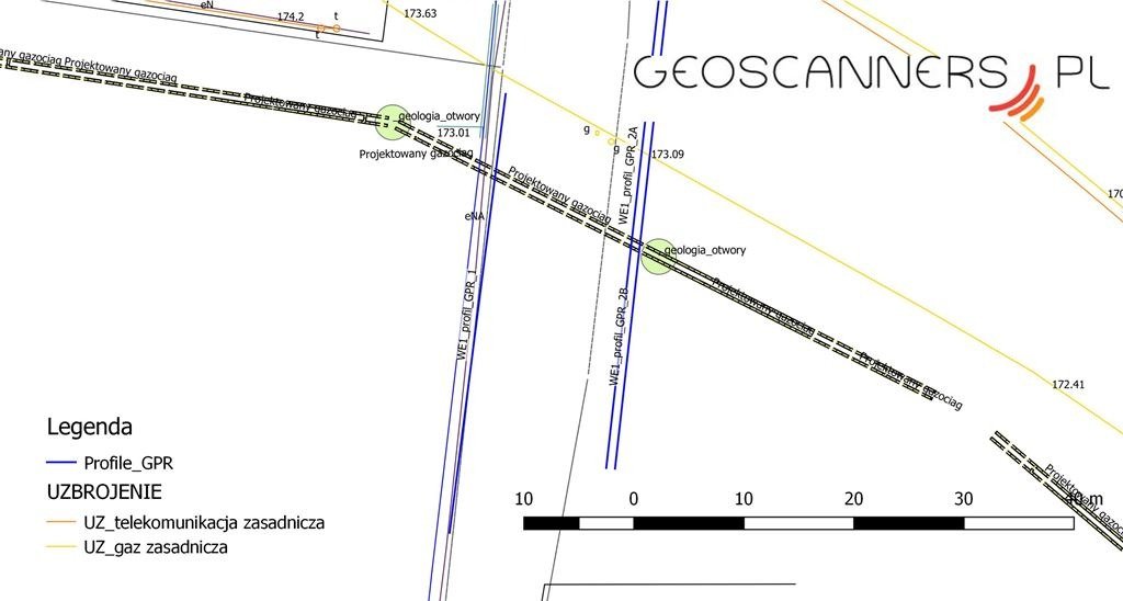
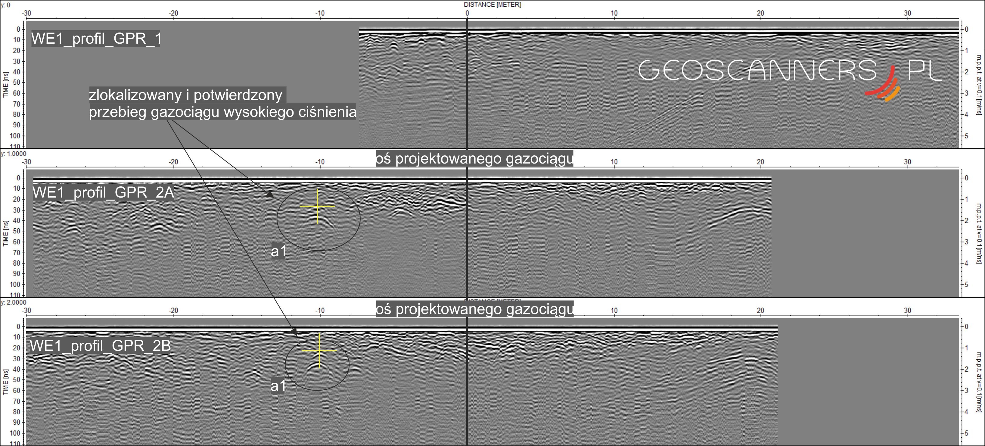
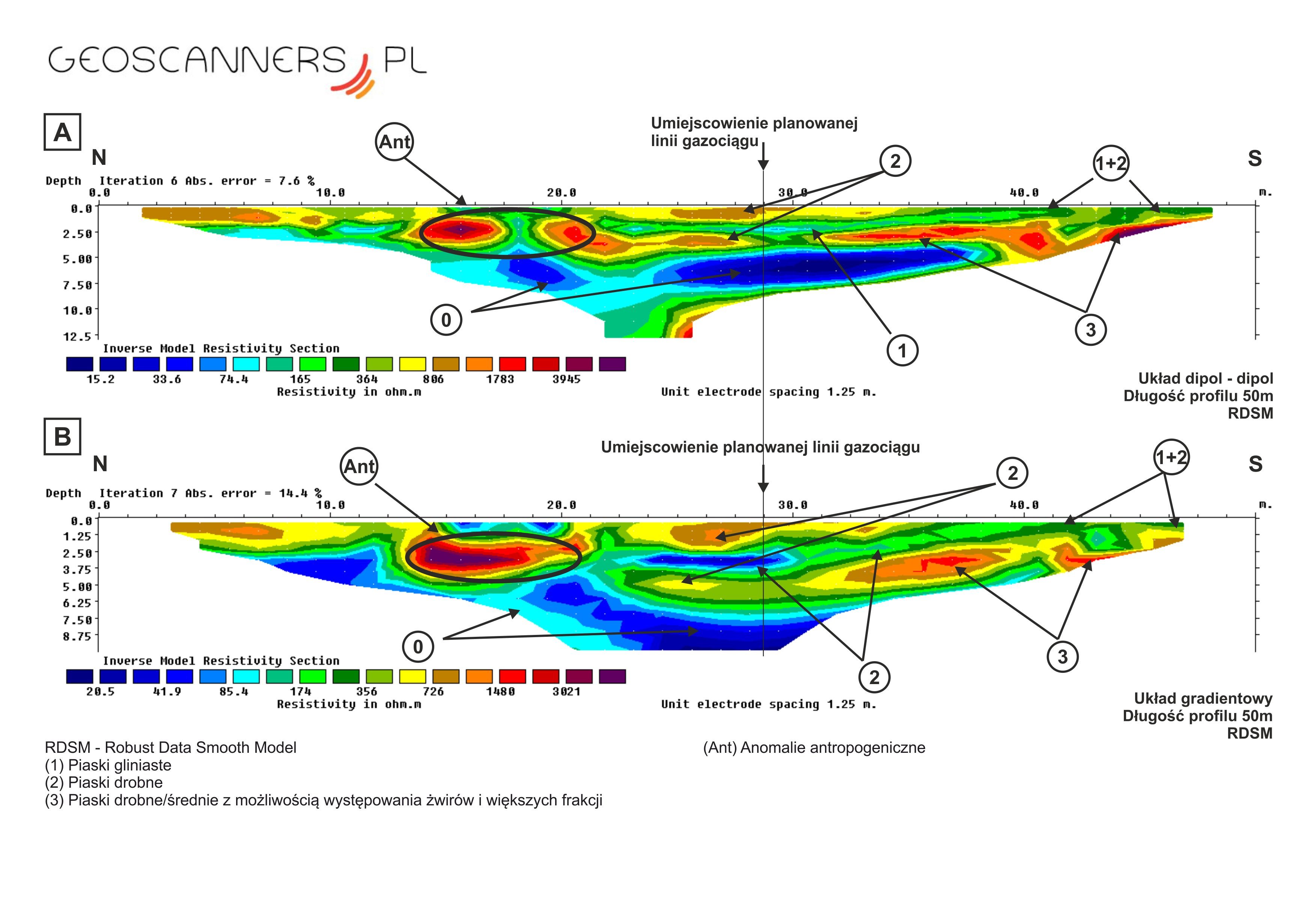
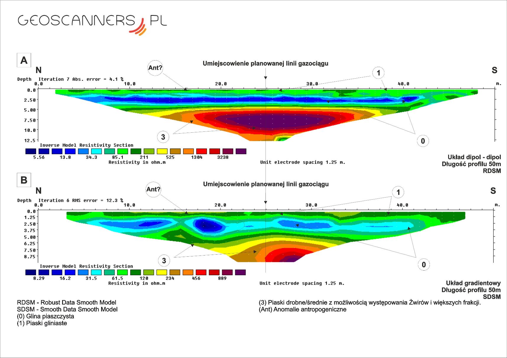
Below examples data were surveyed by ERT (Electro Resistivity Tomography) and GPR imaging on the lines of planing HDD operation. There was planing high pressure LNG pipeline thats why customer wanted recognize very well whats happening under the ground before start drilling operation.