GPR geological prospection for geologist and construction companies
GPR is perfect tool for geologists, but we have to remember that is non-destructive electromagnetic technique and we cannot obtain ground mechanical parameters. Geoscanner we can use as a geophysical support and correct use can bring valuable information. Without any doubt georadar is a quick and non-destructive method. GPR can answer and explain for many question and doubts as a continuous profiling instead of point drilling information. Of course GPR geological prospection should be correlate with information from drilling cores to obtain the best results.
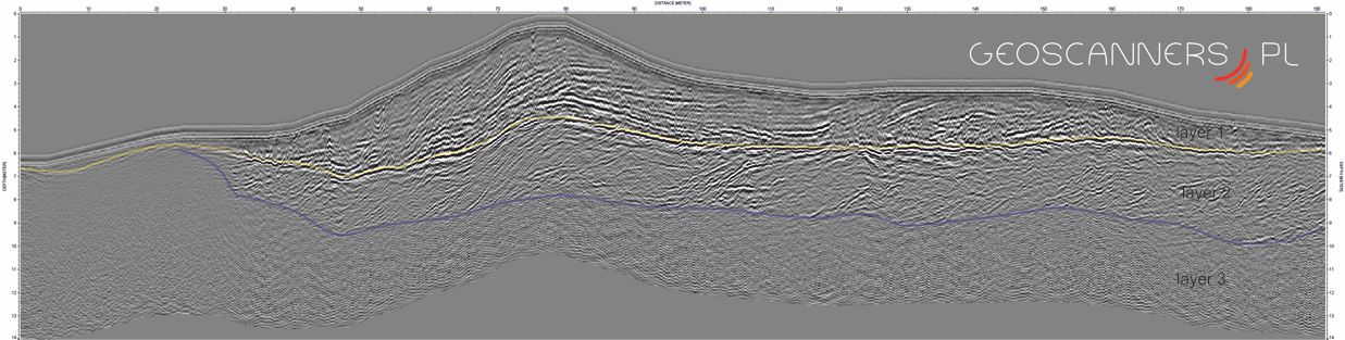
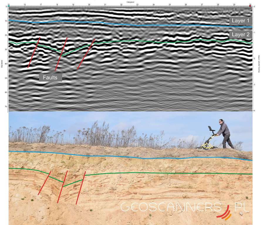
Below several examples of geological prospection using Ground Penetrating Radar.
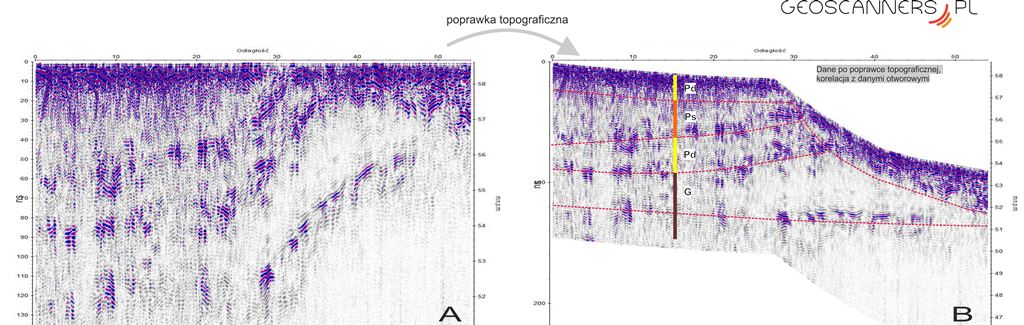
We provide wide range of geophysical prospection in geology where non-destructive technique is needed. We are not close to other survey methods. Thanks to obtained LiDAR data or classic elevation model we apply topographic correction for collected data. We prepare migrated section with special algorithms in the case of rough terrain to reconstruct wave-field in the surveyed structure.